Bringing the spirit of a thriving ecosystem into the real world through scientifically rigorous, ethically grounded, and joy-infused environmental solutions. Where Advanced Geospatial Analytics Meets Sustainable Environmental Engineering & Eco-Tourism Solutions.
“To protect, restore, and celebrate our natural environment through expert environmental assessments, climate action, and sustainable experiences—guided by respect for people, ecosystems, and future generations.”
“A world where development and nature thrive together, and where every community enjoys resilient ecosystems, meaningful climate solutions, and respect for life in all its forms.”
Showing unwavering respect for people, places, and planet at every decision point, powered by science-based, transparent, and accountable action.
Nature inspires joy. We infuse well-being into our professional engineering, health analytics, and community eco-tourism experiences.
Tailoring solutions with empathy and excellence while nurturing ecosystems and climate outcomes for tomorrow's generations.
Ecolacia Ltd is the environmental partner for forward-thinking organizations and communities seeking credible environmental assessments, climate mitigation solutions, sustainable nature experiences, and stewardship services—grounded in science, delivered with heart.
Ecolacia Ltd positions itself at the intersection of rigorous scientific compliance, cutting-edge spatial intelligence, and community-driven climate resilience. We bridge regulatory obligations into real-world sustainability opportunities across East Africa and beyond.
| Core Value | Description |
|---|---|
| Respect | For people, places, and planet—at every single decision point. |
| Integrity | Science-based, transparent, and fully accountable environmental action. |
| Joy & Well-Being | Nature inspires joy; we infuse holistic well-being into our work and experiences. |
| Service | Solutions tailored to clients and communities with empathy, speed, and technical excellence. |
| Stewardship | We actively nurture ecosystems and positive climate outcomes for tomorrow. |
| Collaboration | Building lasting partnerships with communities, governments, and global networks. |
• Knowledgeable & trustworthy
• Warm & inspiring
• Grounded yet forward-thinking
• Respectful and uplifting
✔ Clear & precise (for technical work)
✔ Earth-centric and human (for tourism/climate communications)
✔ Encouraging, positive, and solution-oriented

Ecolacia is anchored by Daniel Macharia Njau, a premier Environmental/GIS Lead Expert with over 25 years of cross-functional industry exposure.
* Formally trained by NASA, USAID, and the USGS in Rapid Land Cover Mapping and Flood Tool Engineering. Author & co-author of over a dozen peer-reviewed scientific publications in international healthcare and environmental journals.
Transforming complex regulatory compliance hurdles, advanced spatial technology, and specialized hydrologic engineering into strategic sustainability opportunities.
Technical Foundation: Backed by extensive technical assistance with the US CDC, Global Implementation Solutions (GIS), DHIS2 Academy Certification, and DrPH doctoral research in geospatial climate-health integration.
Baseline ecological surveys, social/biodiversity assessments, and comprehensive regulatory reports in full alignment with NEMA requirements and World Bank frameworks.
Rigorous operational performance mapping, institutional compliance tracking, resource use optimization, and strategic mitigation scheduling.
Technical Foundation: Certified in collaboration with Moi University (Kenya), K.U. Leuven (Belgium), and Free University of Brussels.
Custom GIS flood mapping tools for assessing the spatial extent of inundation, calculating discharge volumes, and building urban/regional disaster response platforms.
Technical Foundation: Developed in joint technical collaboration with the United States Geological Survey (USGS).
High-resolution satellite image processing, operational land cover classification, and automated tracking for natural resource ecosystems and IGAD Thema operational services.
Technical Foundation: Certified through RCMRD, NASA, USAID, USGS, SERVIR Global, AMESD, and EU DevCoCast.
Design, deployment, and performance tuning of ArcGIS Server Enterprise coupled with Microsoft SQL Server, optimization of fast-tracking spatial workflows, and spatial data infrastructure (SDI) management.
Technical Foundation: Enterprise ESRI Inc. (San Diego, USA) and Juniper GIS certifications.
Voluntary Carbon Market alignment tracking, baseline footprint analytics, and verified high-integrity carbon reduction framework mapping.
Value Proposition: Deep connection with nature, empowering communities, and inspiring stewardship.
Explore sustainable eco-tourism journeys that balance wildlife conservation with authentic community empowerment.
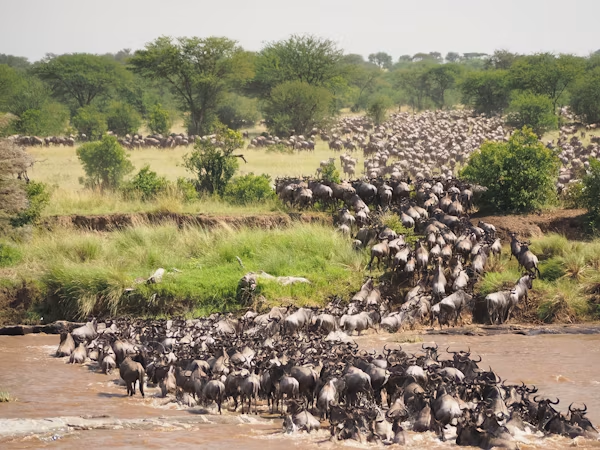
Famous For: The Great Wildebeest Migration & High Density Predator Sightings.
World-renowned for its rolling savannah grasslands, exceptional populations of lion, leopard, and cheetah, and the iconic annual Mara River crossing.
Photo by Jorge Tung, Free to use under the Unsplash License
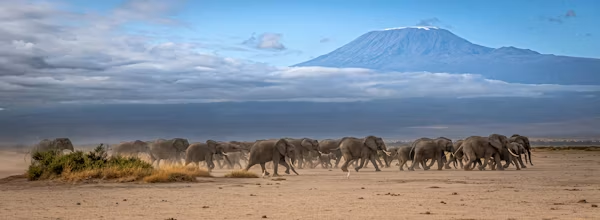
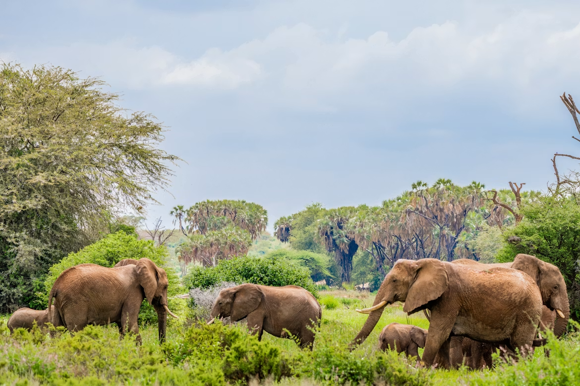
Famous For: Large Elephant Herds & Views of Mt. Kilimanjaro.
Offers unobstructed, scenic views of Africa’s highest peak alongside vast wetland swamps that sustain giant bull elephants and diverse bird species.
Photo by Erwin Gerber, Free to use under the Unsplash License
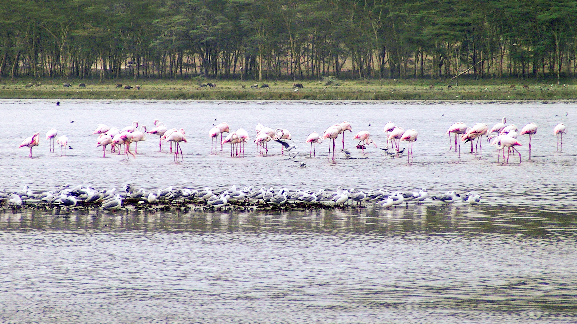
Famous For: Rhino Sanctuary & Rift Valley Alkaline Lake Flamingo Swarms.
A sanctuary for both Black and White Rhinoceroses, framed by dramatic cliff points, acacia forests, and millions of waterbirds.
Photo By Lyfec - Own work, CC BY-SA 4.0
Famous For: The 'Samburu Special Five' & Ewaso Nyiro River Ecosystem.
Home to rare northern endemic species: Grevy's Zebra, Somali Ostrich, Reticulated Giraffe, Beisa Oryx, and the Gerenuk.
Photos By Beks - Free to use under the Unsplash License
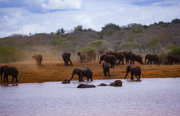
Famous For: Red Elephants, Lugard Falls & Mzima Springs.
One of the world's largest conservation areas, famous for dust-red elephants, volcanic lava flows, and ancient underground natural springs.
Photo by Evans Dims, Free to use under the Unsplash License
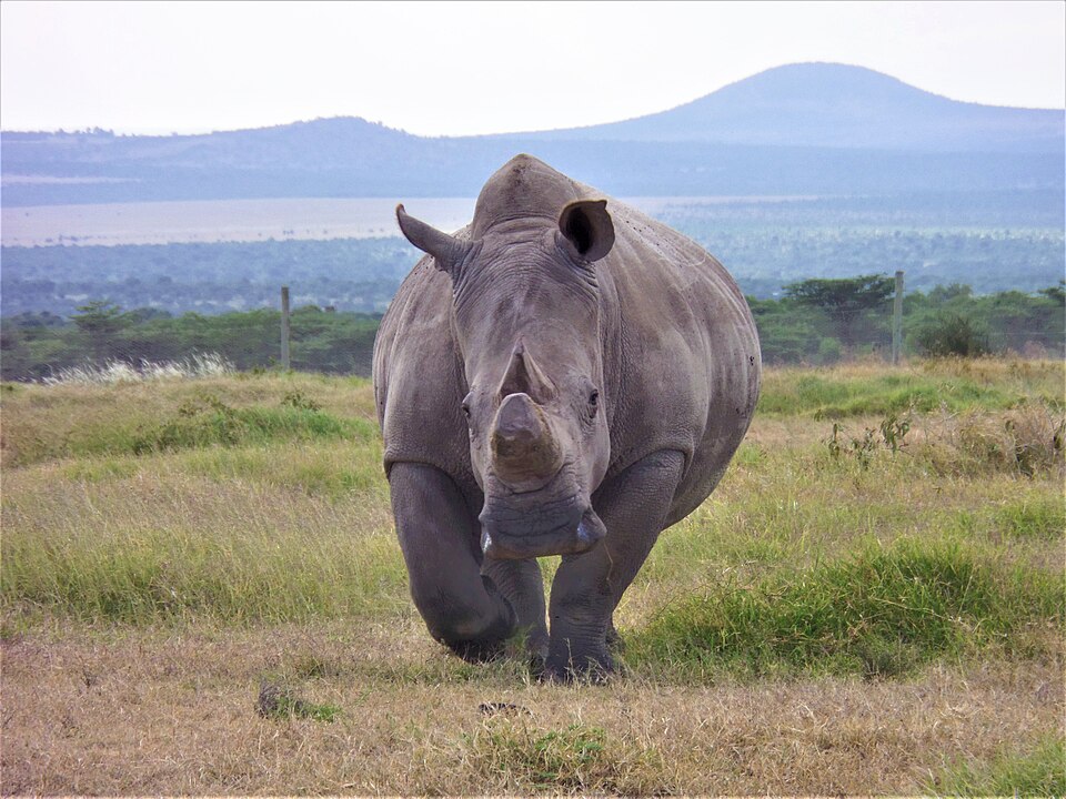
Famous For: Last Northern White Rhinos & Chimpanzee Sanctuary.
A non-profit wildlife conservancy leading groundbreaking rhino breeding science and integrated livestock-wildlife pasture management.
Photo by Karimi Ngore, Creative Commons Attribution-Share Alike 4.0 International
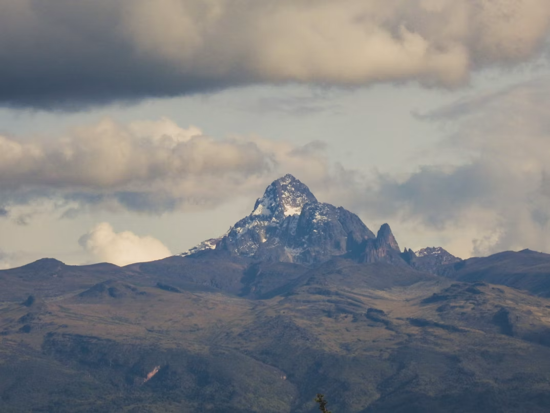
Famous For: Equatorial Glaciers, High Alpine Flora & UNESCO World Heritage Site.
Africa’s second highest peak featuring dramatic afro-alpine vegetation, glacial lakes, and dense montane bamboo forests.
Photo by Alcock Muller, Free to use under the Unsplash License
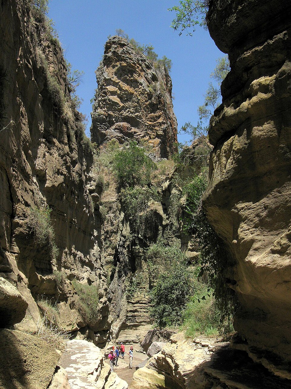
Famous For: Freshwater Boating, Geothermal Gorges & Cycling Safaris.
A freshwater lake haven for hippo pods and fish eagles, paired with Hell's Gate National Park where visitors can walk and cycle alongside wildlife.

Famous For: Coral Reef Snorkeling, Green Sea Turtle Nesting & Mangrove Estuaries.
Protected coastal marine reserve packed with coral gardens, dolphin watching spots, and vital sea turtle nesting grounds.

Famous For: Kenya’s Only Guineo-Congolian Equatorial Rainforest Remnant.
A biodiversity hotspot famous for rare primates, giant ancient trees, hundreds of butterfly species, and exotic rainforest birdlife.
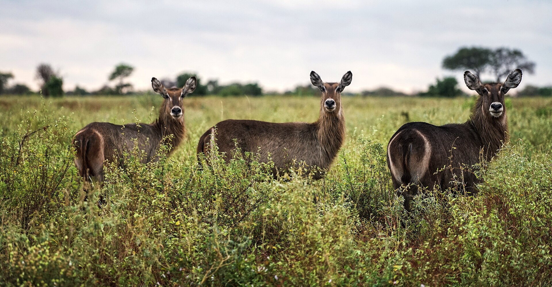
Famous For: Unspoiled Wilderness, Born Free Legacy & Rhino Sanctuary.
Famous as the home where Joy and George Adamson raised Elsa the Lioness. Features 13 rivers, lush palm thickets, and abundant Big Five wildlife.
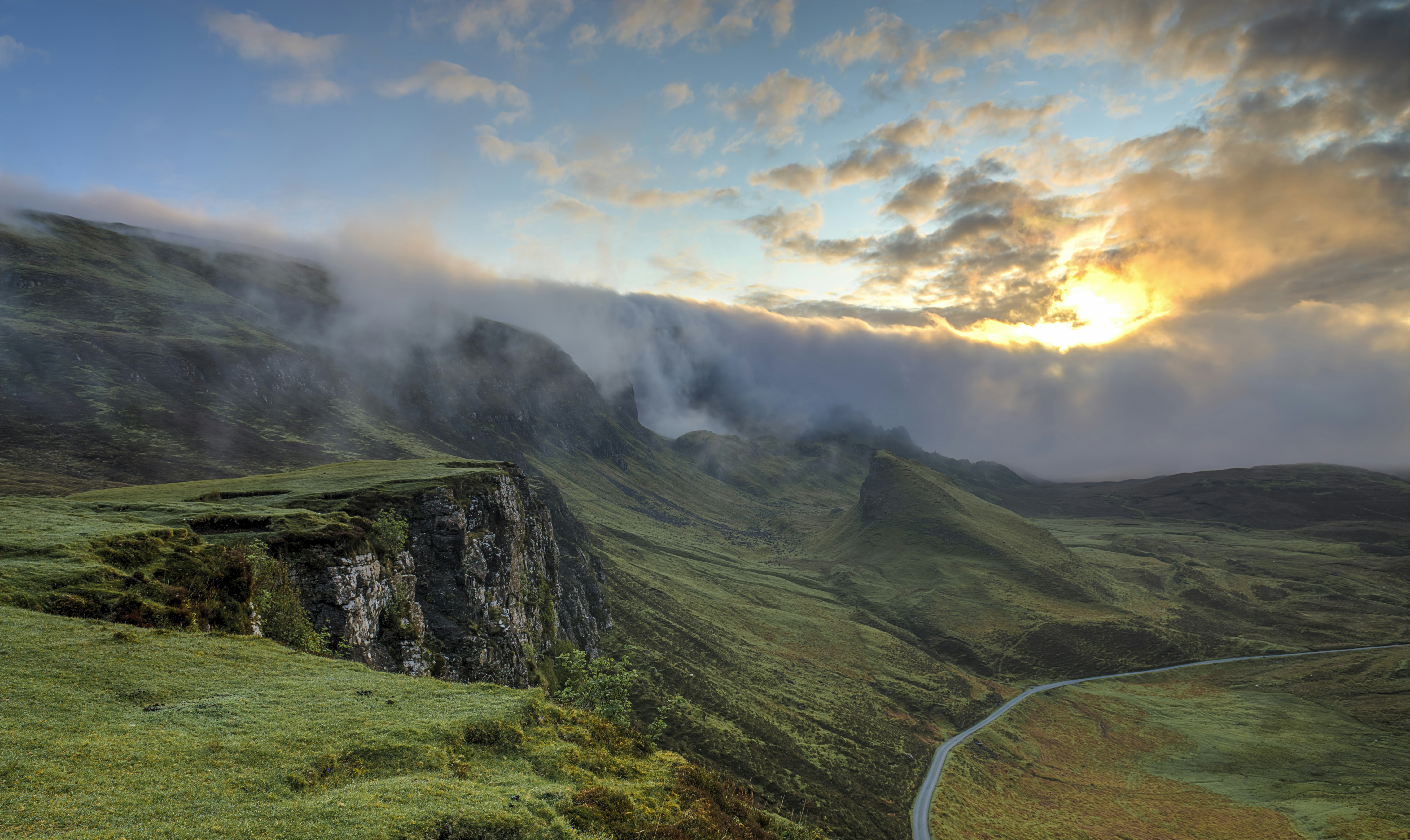
Famous For: High Altitude Waterfalls, Rare Bongo Antelope & Treetop Lodges.
Characterized by steep mist-covered valleys, moorlands, Karuru Waterfalls, and vital highland water catchment ecosystems.
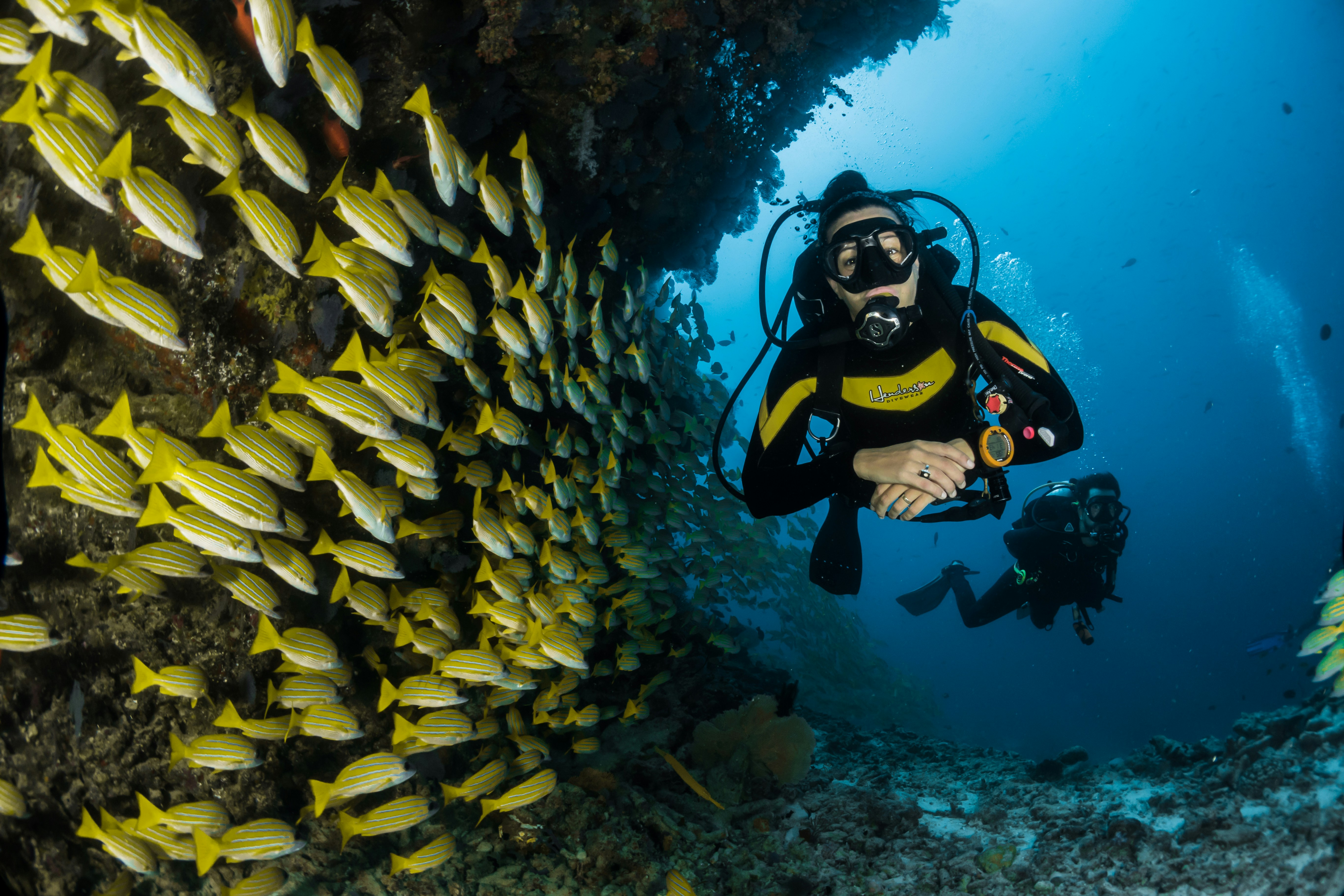
Famous For: Dolphin Safaris, Coral Gardens & Humpback Whale Migrations.
Located near Wasini Island, offering world-class snorkeling, regular sightings of Indo-Pacific bottlenose dolphins, and rich coral reefs.
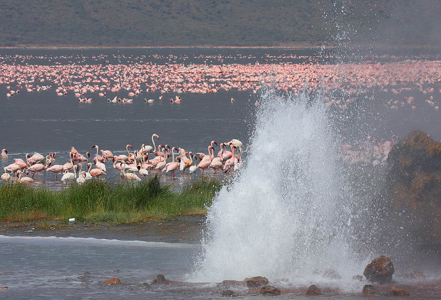
Famous For: Geothermal Hot Springs, Geysers & Massive Flamingo Populations.
A saline Rift Valley lake renowned for boiling hot springs, bubbling geysers, and providing critical feeding grounds for millions of lesser flamingos.
Photo By Steve Garvie, CC BY-SA 2.0
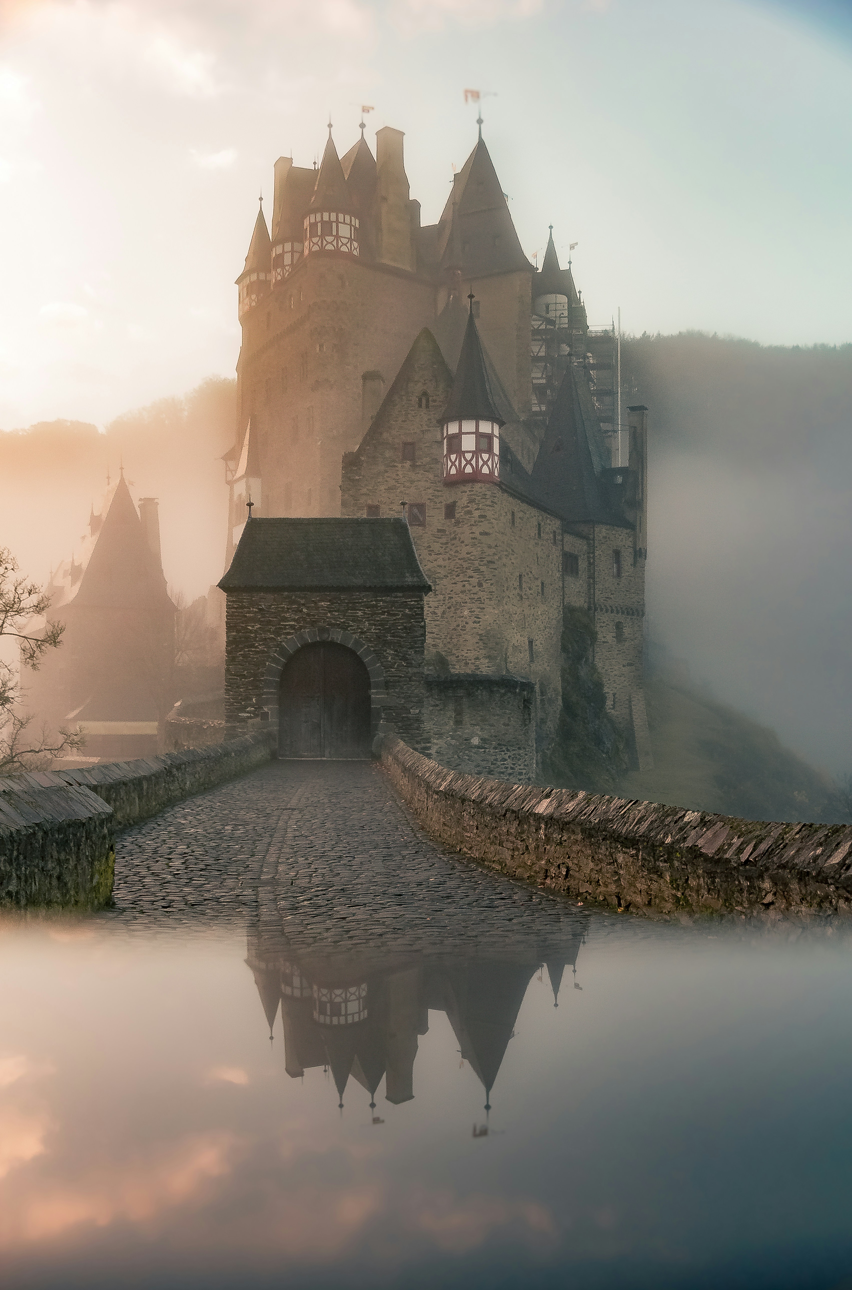
Famous For: Freshwater Birding Haven & Njemps Pokot Cultural Heritage.
A freshwater Rift Valley lake harboring over 470 bird species, Nile crocodiles, and hippos, framed by dramatic volcanic islands.
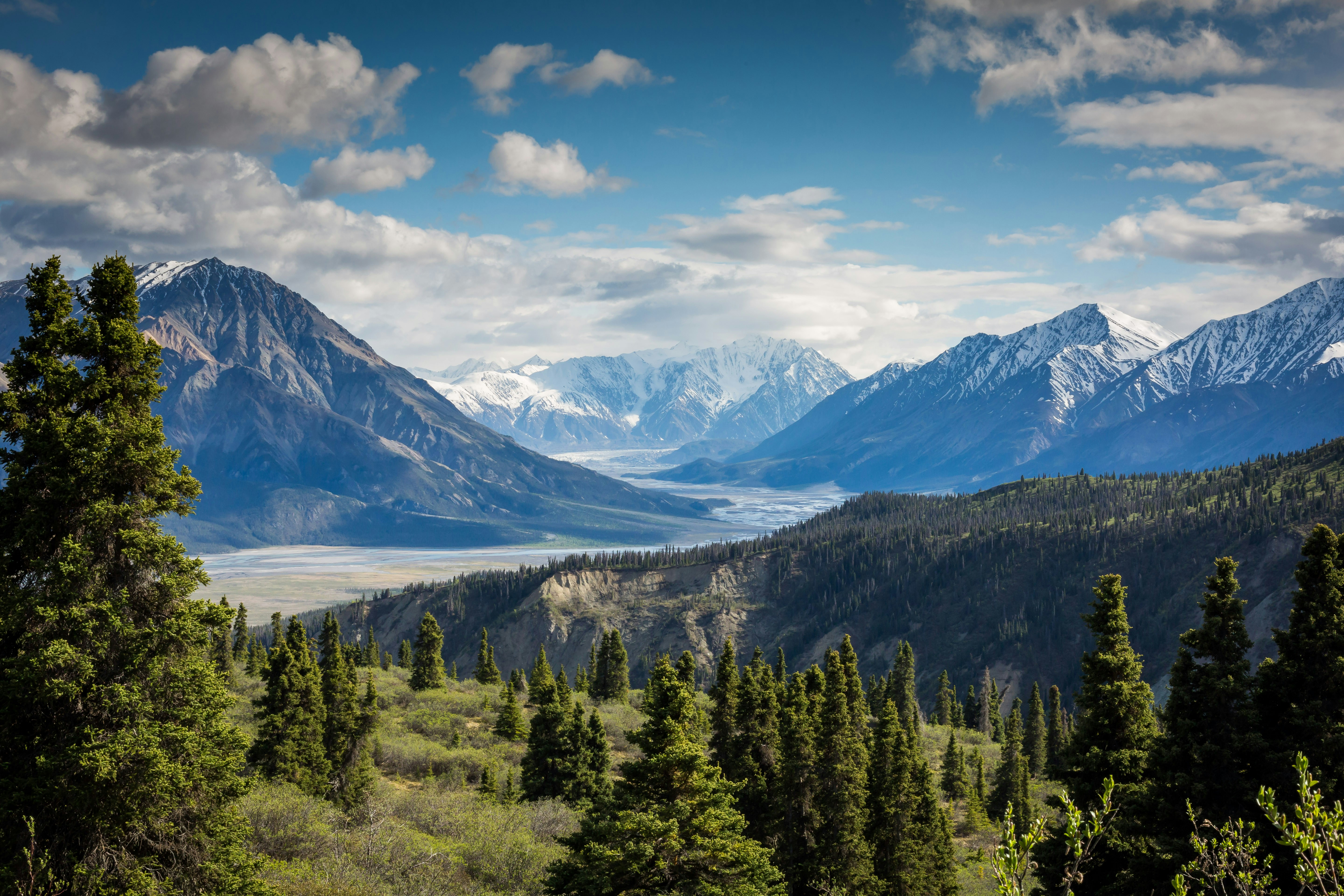
Famous For: Stratovolcano Rim Hiking & Dense Crater Floor Forest.
An extinct stratovolcano featuring a challenging rim trail with panoramic views across the Great Rift Valley and a lush forested caldera floor.
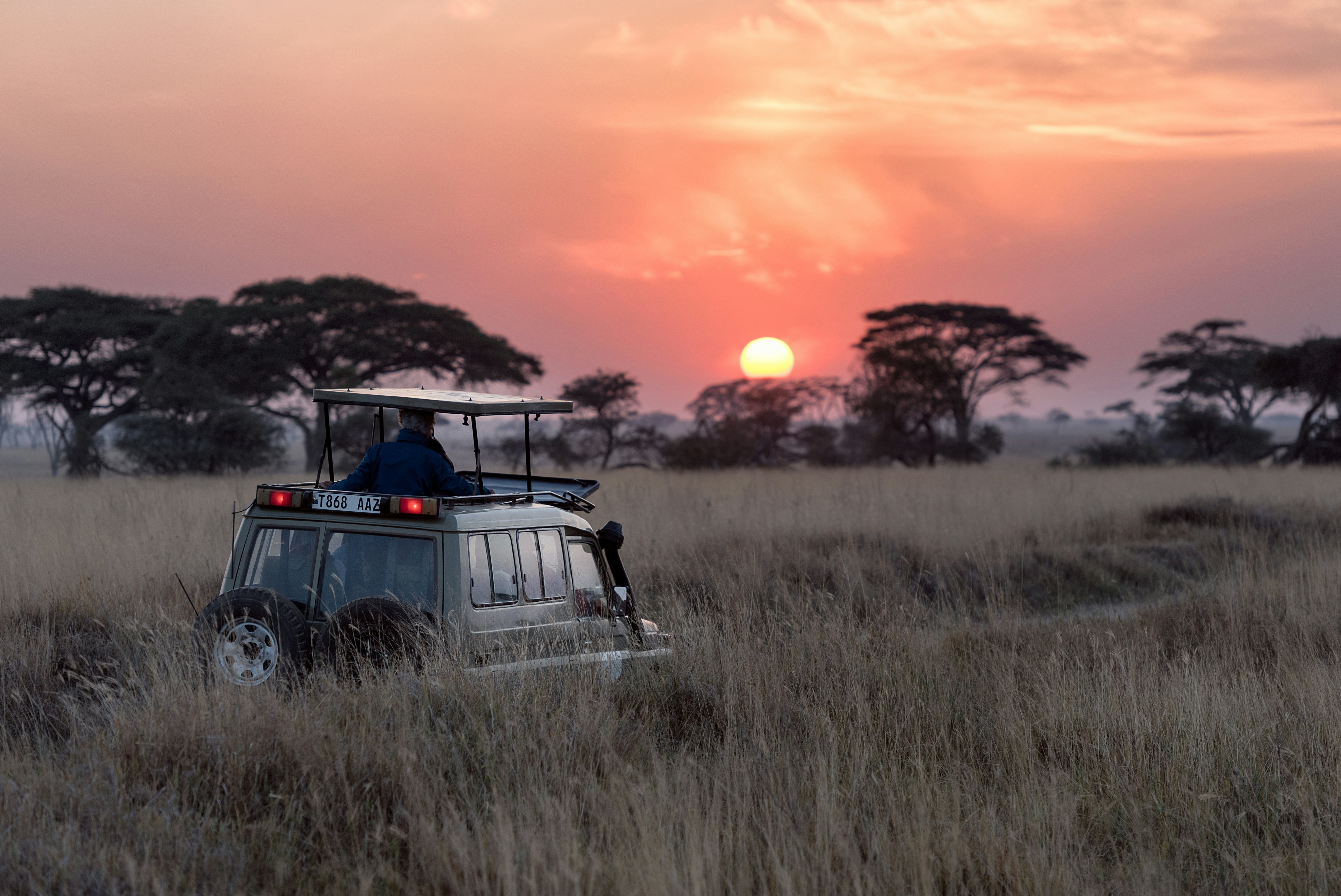
Famous For: Kenya’s Only Population of Sable Antelope & Sheldrick Falls.
Coastal rainforest and grassland reserve protecting rare plant flora, coastal forest elephants, and the majestic critically endangered Sable Antelope.

Famous For: Golden-rumped Elephant Shrew & Endemic Coastal Birds.
The largest remaining block of coastal rainforest in East Africa, home to the Sokoke Scops Owl, Clarke’s Weaver, and rare butterflies.
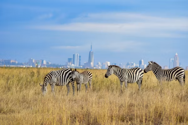
Famous For: World’s Only Capital City Wildlife Park & Black Rhino Breeding sanctuary.
Where free-roaming wildlife graze against a backdrop of city skyscrapers. Renowned for its high density of black rhinos and lions.
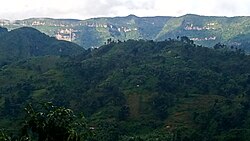
Famous For: Kitum Cave Salt-Mining Elephants & Ancient Volcanic Caldera.
An extinct shield volcano featuring subterranean lava tube caves where elephants venture deep underground to lick natural salt minerals.
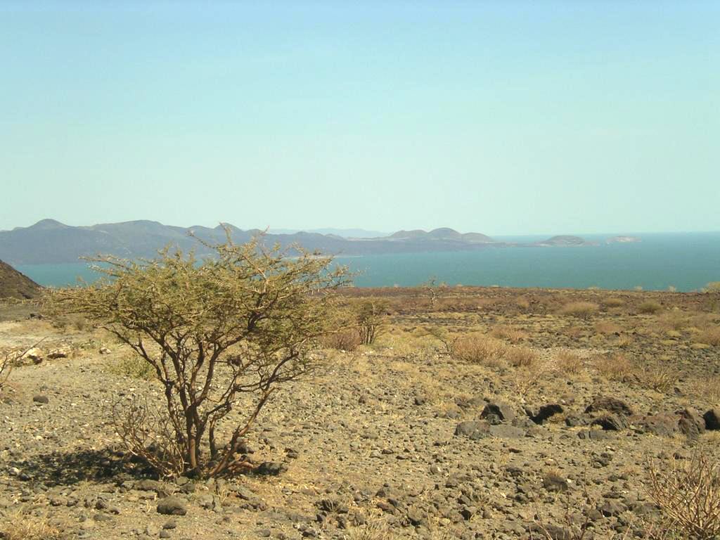
Famous For: Cradle of Humankind (Koobi Fora) & Petrified Forests.
Located on the wild shores of Lake Turkana, renowned for world-changing hominid fossil discoveries, petrified trees, and Nile crocodile breeding grounds.
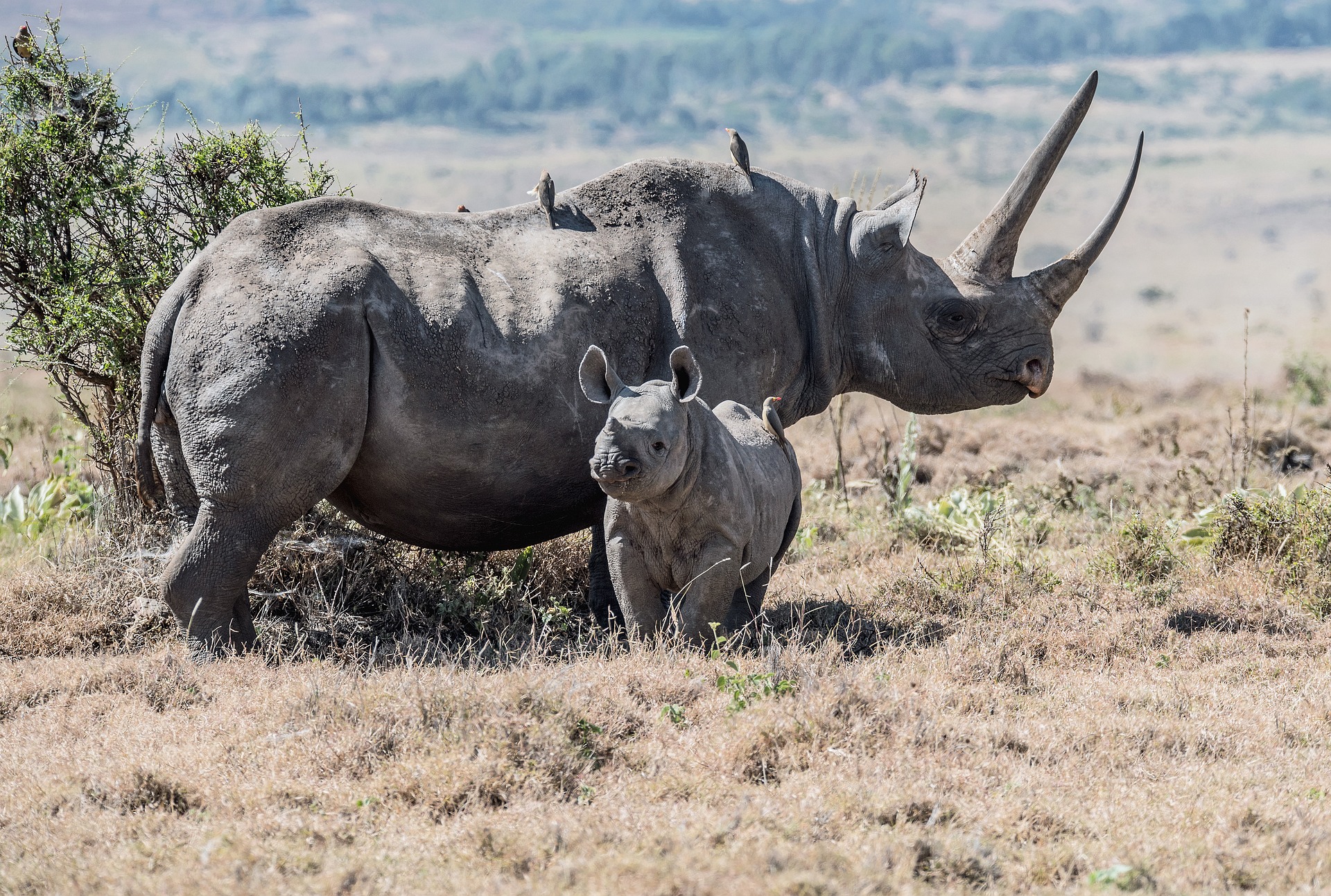
Famous For: Pioneer Rhino Protection & Grevy’s Zebra Conservation.
A UNESCO World Heritage extension site leading Africa in community-centric rhino conservation and wildlife corridor connectivity.
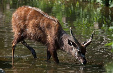
Famous For: Rare Semi-Aquatic Sitatunga Antelope & Boardwalk Trails.
Kenya’s smallest national park, offering peaceful walking boardwalks through bulrush swamps to observe web-footed Sitatunga antelopes and De Brazza’s monkeys.
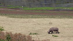
Famous For: Lake Paradise Crater Lake & Big-Tusked Elephants.
An oasis of mist-draped montane rainforest rising out of the northern desert, historical home of Ahmed, the famous big-tusked elephant.
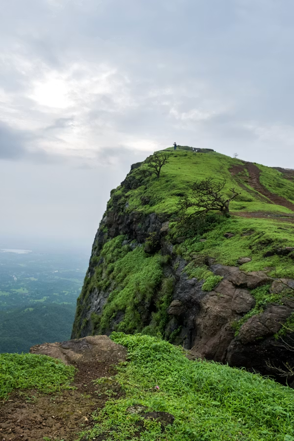
Famous For: Green Rolling Volcanic Hills & Leviathan Cave Systems.
Hemingway's "Green Hills of Africa," featuring young volcanic lava cones, deep underground lava tube caves, and views of Kilimanjaro.

Famous For: Powder-White Sands, Whale Shark Watching & Colobus Conservation.
Voted among Africa’s top beaches, combining coral reef eco-tours with coastal shade sanctuaries for the endangered Angolan Colobus Monkey.
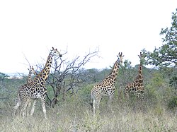
Famous For: Tana & Thiba River Confluence & Boat Safaris.
A quiet wilderness domain dominated by acacia woodland, open savannah, and reservoir lakes rich in hippos, crocodiles, and waterbirds.
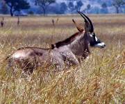
Famous For: Last Refuge of the Endangered Roan Antelope.
Located in the Lambwe Valley near Lake Victoria, this park is the sole remaining habitat in Kenya for the magnificent Roan Antelope.
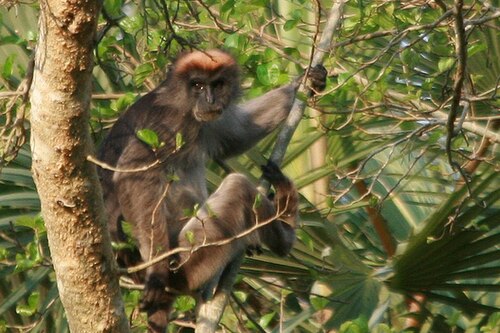
Famous For: Endemic Tana River Red Colobus & Crested Mangabey.
A critical gallery forest ecosystem along the lower Tana River dedicated to protecting two critically endangered primate species found nowhere else.
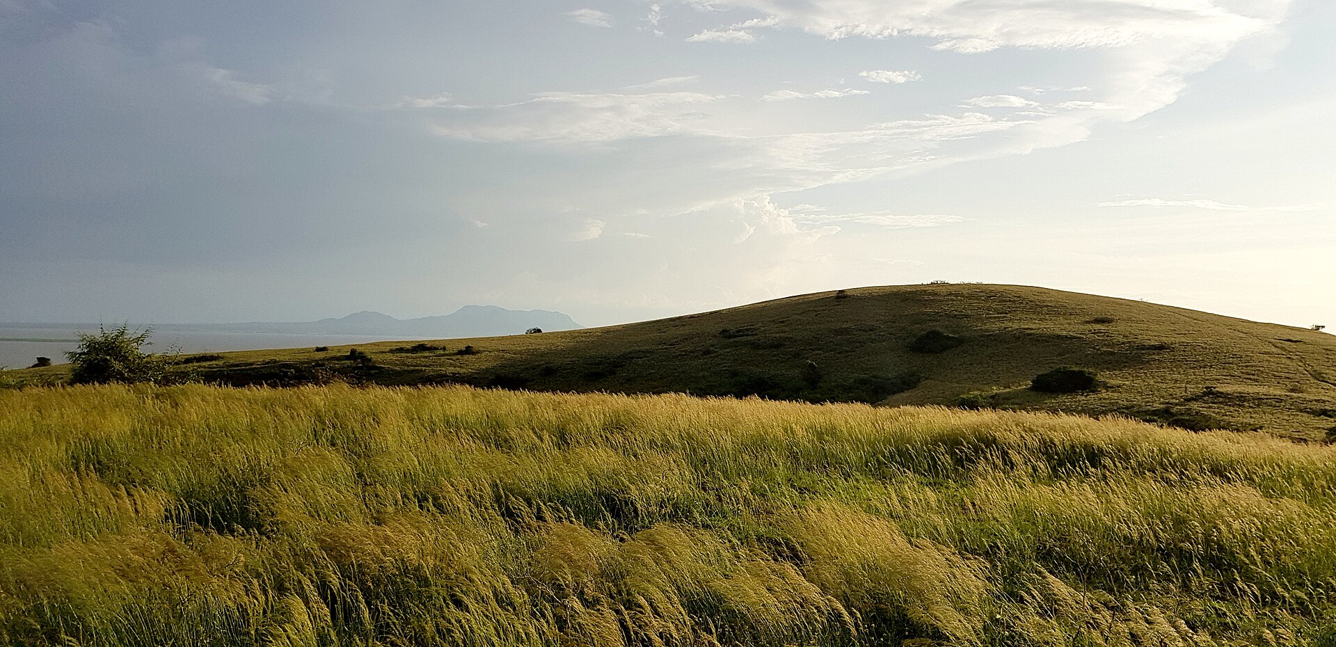
Famous For: Lake Victoria Island Haven & Rare Fish Eagle Densities.
Known in local Luo folklore as "Chwaa" (place of destination), this tranquil island sanctuary on Lake Victoria is packed with hippos, impalas, and birdlife.
Integrating geospatial intelligence, public health surveillance, and climate dynamics to strengthen health system resilience, outbreak preparedness, and disease monitoring across Sub-Saharan Africa.
| Specialized Domain | Key Tasks & Strategic Contributions | Impact / Institutional Alignment |
|---|---|---|
| Global Health Security Agenda (GHSA) | Coordination and technical support for multi-agency health security implementation teams across national public health networks. | U.S. Embassy Eagle Award Recognized for exceptional team coordination & GHSA execution. |
| Laboratory Capacity Mapping | Geospatial mapping of public health laboratory diagnostic capabilities, pathogen detection networks, and biosafety levels. | 1st Place Poster Award Awarded at the US CDC DGHP Annual Conference. |
| PHEOC & Outbreak Response | Spatial integration and operationalization of subnational PHEOCs during regional outbreaks and pandemic responses. | Published in Health Security (2025). |
| Pathogen & Environmental Surveillance | Spatial modeling of environmental transmission pathways for enteric and respiratory pathogens in urban slums and rural health systems. | Published in PLoS NTDs & BMC Public Health. |
| Digital Health & HIS (DHIS2) | System design, customization, and deployment of DHIS2 surveillance modules and mobile health tools. | DHIS2 Certified Design & Customization Professional Certification. |
| International Technical Assistance | Selected for US CDC Atlanta Headquarters Experience & Technical Assistance (HETA) program for international health security systems. | Advanced US CDC HETA Certification. |
Key infrastructure, conservation, and modeling assignments executed with institutional diligence across East Africa.
| Project & Client / Document Tracking | Location | Scope / Focus |
|---|---|---|
| HYDROLOGICAL RISK ASSESSMENT REPORT (Seasonal Rains 2026 and El Nino Rains 1997) | Nairobi Railway City Phase 1 (MICE Core Arena Site) | Spatial Risk Modeling Flood risk simulation, peak water depth extraction, and urban climate resilience diagnostics. |
| Regulatory Impact Assessment (RIA) For The Implementation of Proposed E-Waste Regulations, 2024 (2025) National Environment Management Authority (NEMA) |
Nairobi | Regulatory Analysis Environmental Expert position evaluating regulatory impact pathways for e-waste management frameworks. |
| E-Waste Transfer Centers ESIA National Environment Management Authority |
Mombasa, Nairobi, Nakuru, Kisumu | Compliance Infrastructure design following World Bank Environmental frameworks. |
| Gigiri Conference Center Expansion United Nations Office at Nairobi (UNON) |
Nairobi City County | EIA Study Comprehensive master plan validation and environmental planning. |
| Smart Streetlighting PPP Transaction Nairobi City County & Gov of Kenya / PIDG |
Nairobi County | ESIA Advisory Transaction advisory environmental impact framework mapping. |
| ESIA for Proposed Multi Dwelling Units (4 Town Houses) on LR. NO. 2259/316 Ndege Road (2024) Orange Valley Ltd |
Karen, Langata, Nairobi City County | ESIA Study Environmental/GIS Expert conducting baseline ESIA for residential multi-dwelling town house developments. |
| EIA for Proposed Spring Valley Base Transceiver Station (BTS) (2024) ATC Kenya Ltd |
Parklands/Highridge, Westlands, Nairobi City County | EIA Study Environmental/GIS Expert carrying out environmental assessments for telecommunications infrastructure development. |
| EIA for Proposed Mugumo Crescent Loresho Base Transceiver Station (BTS) (2024) ATC Kenya Ltd |
Loresho / Kyuna Road, Kitisuru, Nairobi City County | EIA Study Environmental/GIS Expert leading regulatory EIA for wireless communication infrastructure placement. |
| EIA for Proposed Fair Acres Base Transceiver Station (BTS) (2024) ATC Kenya Ltd |
Karen C / Fair Acres Road, Lang'ata, Nairobi City County | EIA Study Environmental/GIS Expert conducting EIA within institutional and residential zones. |
| EIA for Proposed Northern Bypass Fourways Base Transceiver Station (BTS) (2024) ATC Kenya Ltd |
Roysambu / Fourways Junction, Nairobi City County | EIA Study Environmental/GIS Expert executing site environmental impact studies along road reserve infrastructure. |
| Annual Environmental Audits for Atua Enkop Africa Luxury Camps (2012 – Present) Atua Enkop Africa Luxury Camps |
Lake Nakuru, Maasai Mara, Samburu | Environmental Audit Environmental/GIS Expert conducting annual operational compliance audits for Mara Ngenche Safari Camp, Elephant Bedroom Camp, and Mbweha Camp. |
| Annual Environmental Audits for Sun Africa Hotels (2011 – Present) Sun Africa Hotels Ltd |
Lake Nakuru, Maasai Mara, Amboseli, Lake Naivasha, Nyali | Environmental Audit Environmental/GIS Expert evaluating eco-compliance for Keekorok Lodge, Lake Naivasha Country Club, Sovereign Suites, Nyali Sun Africa Beach Hotel & Spa, and Sun Africa Beach Resort. |
| Annual & Initial Environmental Audits for Sopa Lodges Countrywide (2011 – Present) Sopa Lodges |
Lake Nakuru, Maasai Mara, Amboseli, Lake Naivasha, Samburu | Environmental Audit Environmental/GIS Expert overseeing initial and ongoing environmental audits across all regional hospitality developments. |
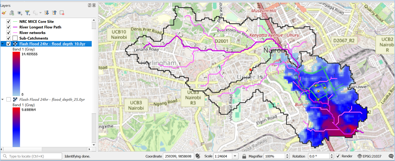
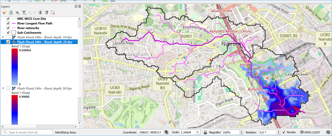
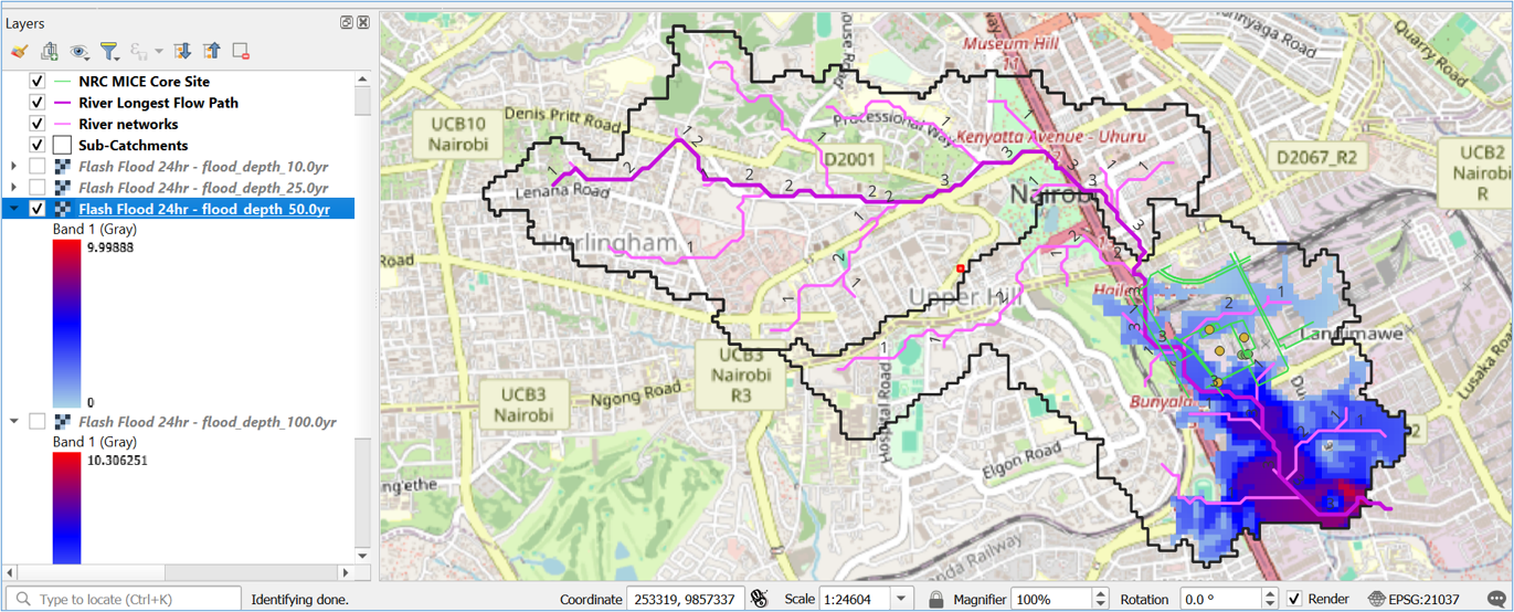
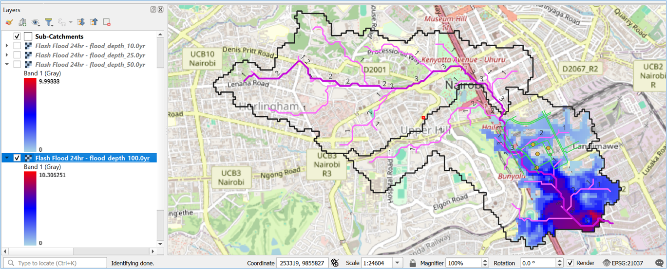
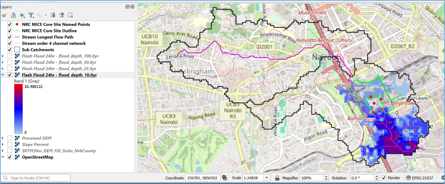
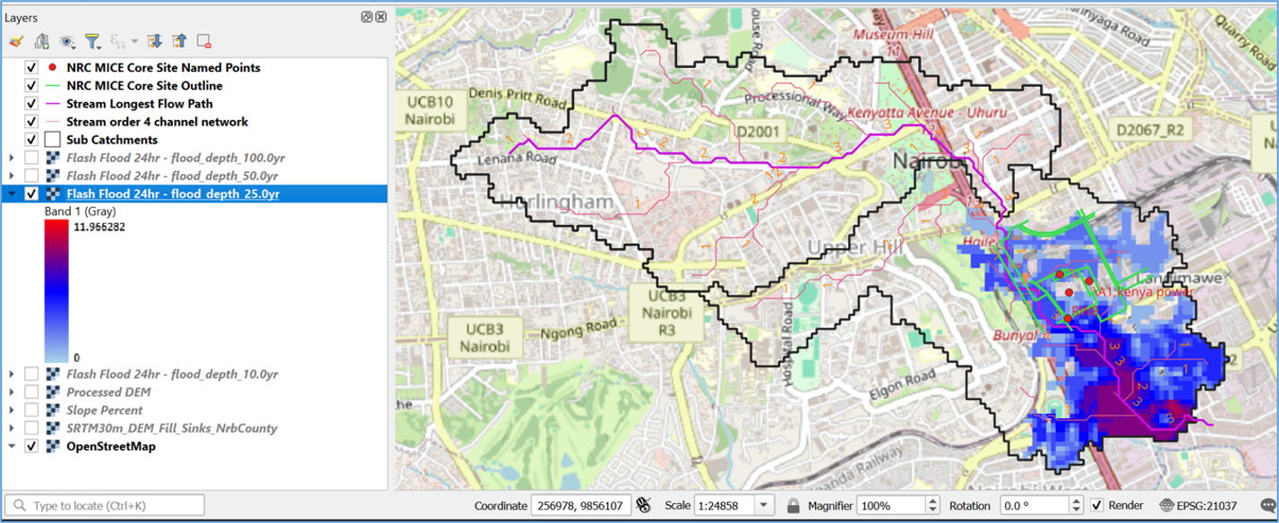
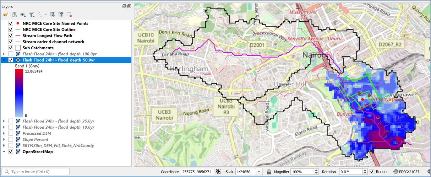
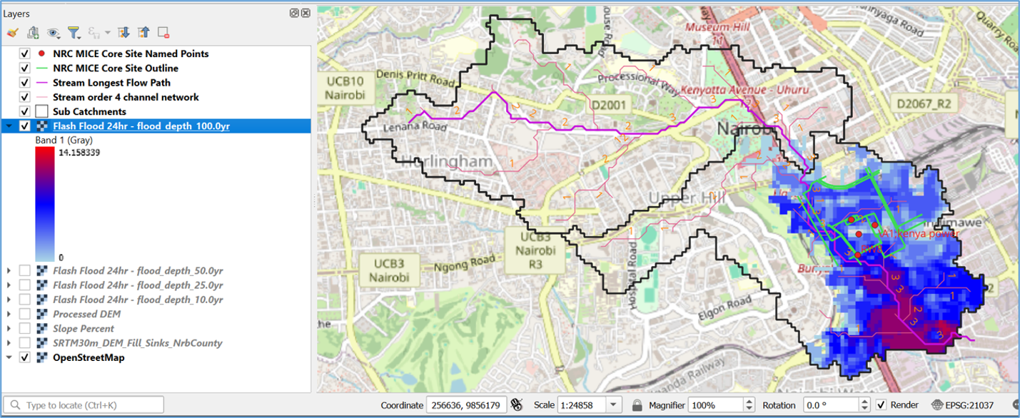
Our modeling division uses specialized spatial tools to run scenario checks for critical climate infrastructure projects, simulating seasonal changes such as convective storm scenarios and historical weather analogues (e.g., El Niño historical volume assessments).
* Spatial simulation outputs map flood depth metrics across 10-year, 25-year, 50-year, and 100-year return variations to maximize infrastructural resilience.
Select a climate scenario and return-period variation below to visualize peak flood depths ($m$) and catchment runpaths.
Evaluate the potential annual ecological asset footprint of your ecosystem development.
Blending strict regulatory compliance, precision spatial mapping, and ecological stewardship to deliver world-class advisory solutions across East Africa.
Select your area of inquiry below to route your request directly to our specialized practice teams.